
Reviewed · PUERTO RICO
Puerto Rico Unlocked 500+ Hidden Gems and Spots
Puerto Rico rewards curiosity. This phone-based map brings together more than 500 carefully selected places across the island, from quiet beaches and river pools to churches, plazas, caves, viewpoints, and food stops. You tap a location, open Google Maps, and set off on your own schedule. I especially like the one-click navigation and the sheer range of choices. You can plan a full road trip or find a nearby stop when your afternoon suddenly opens up.
I also like the lifetime access and regular updates, which give the $29.99 group price real value for families or friends sharing one purchase. The main drawback is that this is not a guided excursion. You need a rental car, your own judgment, and some planning, while entrance fees, fuel, tolls, parking, food, and safety equipment cost extra.
In This Review
- Key points before you buy
- What Puerto Rico Unlocked actually is
- Eight ways to shape your island trip
- Day 1: 87 rivers around Río Grande
- Day 2: 105 beaches near Aguadilla
- Day 3: 21 viewpoints in the Lares area
- Day 4: Forts, churches, tunnels, and colonial buildings near Aguada
- Day 5: Nine food stops around Luquillo
- Day 6: More than 50 unusual places around Ponce
- Day 7: More than 50 town plazas around Toa Alta
- Day 8: More than 87 sacred sites near Carolina
- Why the map can save serious planning time
- Price, group value, and the real extra costs
- Who will get the most from this experience
- How to use the map without wasting your vacation
- Should you buy Puerto Rico Unlocked?
- FAQ
- How much does the Puerto Rico map cost?
- How many locations are included?
- Is this a guided tour?
- How do I navigate to each location?
- How long is the experience?
- Do I need a rental car?
- Are entrance fees included?
- Are meals and drinks included?
- Is equipment provided for river or cave visits?
- What should I know before visiting rivers?
Key points before you buy
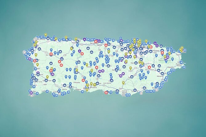
- 500-plus locations across Puerto Rico: The map covers beaches, rivers, waterfalls, caves, plazas, churches, forts, food stops, viewpoints, and unusual places.
- Direct Google Maps links: Each pin is designed to take you straight into navigation from your phone.
- Eight themed exploration days: The plan groups the island’s choices into rivers, beaches, viewpoints, historic places, food, unusual sights, plazas, and sacred sites.
- $29.99 per group: One purchase covers a group of up to 15, making the cost low when shared.
- Self-guided freedom: There is no fixed route, guide, transportation service, or required schedule.
- River safety matters: Avoid river outings during cloudy weather or any forecast of rain, since water levels and currents can change quickly.
What Puerto Rico Unlocked actually is
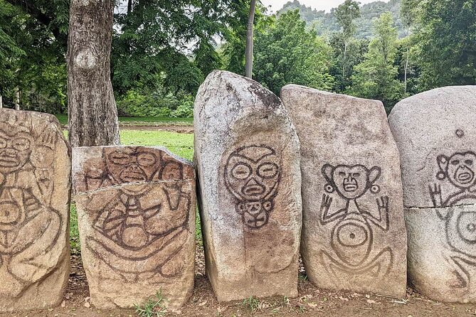
This is best understood as a large digital road-trip planning tool, not a traditional tour. You receive a mobile Google Map with more than 500 locations around Puerto Rico, and each place has a clickable pin connected to navigation.
The map is organized by type, so you can search for the kind of day you want. One morning might be a beach day near Aguadilla. Another might center on a historic church or town plaza. You are not locked into the eight-day outline, and you do not need to visit every stop.
The listings include photos, practical tips, and links. That matters because a plain list of names would not save much time. The useful part is having places gathered in one tool instead of sorting through old blog posts, scattered websites, videos, and social media clips.
You can use the map from your phone at any time. The stated access period runs from September 27, 2024, through December 28, 2026, with lifetime access to the digital map and future additions described as part of the purchase. The activity is available around the clock, from midnight to 11:30 p.m., which reflects its flexible nature rather than a staffed departure time.
What else runs out of Puerto Rico:
- Guided Walking Tour in Ponce
★ 5.0 · 136 reviews - Puerto Rico Countryside Tour with Visit to Waterfall
★ 5.0 · 119 reviews - Panorama VIP Tour in Gran Canaria
★ 4.5 · 90 reviews
Eight ways to shape your island trip
The suggested plan gives each day a theme and roughly four hours of exploration. Treat those four-hour blocks as planning guides, not a rigid schedule. Puerto Rico is a large island, and driving time between pins can turn a simple outing into a long day.
Day 1: 87 rivers around Río Grande
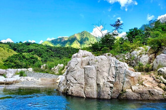
The first group focuses on 87 rivers, waterfalls, and natural pools, with Río Grande serving as the listed area. This is the most adventure-oriented part of the map, and it may appeal to you if swimming in freshwater and finding less obvious outdoor places are priorities.
The map is particularly useful here because river outings can be hard to plan from a generic sightseeing list. Photos and location pins can help you decide which places fit your comfort level and available time. Some sites may require a moderate level of physical fitness, and the map does not provide equipment such as life jackets or helmets.
Take the safety warning seriously. Check the forecast before leaving and visit only when the area is completely sunny with no chance of rain. Rivers can rise quickly after rain, even if conditions look calm where you are. If the day is cloudy or wet, choose a church, plaza, food stop, or town visit instead.
Day 2: 105 beaches near Aguadilla
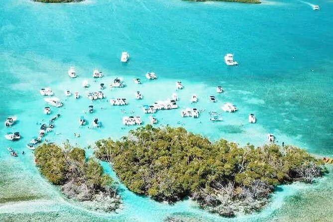
Aguadilla anchors a collection of 105 beaches, ranging from quiet shores to family-friendly places with palms and roadside food stalls. This is one of the strongest sections for building a flexible day, since you can choose based on swimming plans, scenery, food, or simply how far you want to drive.
A map with many beach choices is valuable because you can change course when one spot is crowded, inconvenient, or not suited to your group. You might use the pins to create a short beach-hopping route, or select one location and spend most of the day there.
The tradeoff is that a pin alone cannot replace checking current conditions. The information provided does not promise lifeguards, changing rooms, restrooms, or a particular level of access at every beach. Read the notes attached to each location and plan around your own needs.
Close by, and nothing like it:
- Pinones Bar Hopping Beach Food Tour & Caguas River Hidden Gem
★ 4.5 · 82 reviews - San Juan Arrival Share Transfer
★ 4.5 · 77 reviews - Private Walking Tour of Old San Juan, including forts
★ 5.0 · 72 reviews - Day Sail without transportation
★ 5.0 · 62 reviews
Day 3: 21 viewpoints in the Lares area
The Lares section gathers 21 scenic viewpoints, including high mountain outlooks and views toward the Caribbean. This is a good choice when you want a slower day with stops for photographs rather than a day built around swimming or strenuous activity.
Viewpoints can also give your road trip structure. Instead of driving without a plan, you have a series of possible pauses and can decide which ones fit your route. The photos attached to the pins should help you judge the kind of setting you are heading toward.
You should still leave room for road conditions and daylight. The map does not specify how long each drive takes or whether every viewpoint has formal facilities. Build in extra time, especially if you are combining mountain roads with other parts of the island.
Day 4: Forts, churches, tunnels, and colonial buildings near Aguada
The Aguada collection shifts from outdoor recreation to Puerto Rico’s built and cultural heritage. It includes forts, churches, secret tunnels, and colonial buildings, giving you a way to connect smaller towns and historic sites rather than spending the whole trip at beaches.
I like this category because it broadens the meaning of a Puerto Rico road trip. A church or old building can tell you something about a place in a way a quick scenic stop cannot. The map also includes enough variety for you to keep the day interesting if weather rules out the rivers.
Do not assume that every historic site is open whenever you arrive. The general map access is available daily, but individual buildings may have their own hours, admission rules, or parking arrangements. Check the attached links and notes before setting out.
Day 5: Nine food stops around Luquillo
The Luquillo section lists nine food stops featuring Puerto Rican favorites such as alcapurrias, mofongo, lechón, and tropical juices. This is a practical addition because food planning often becomes an afterthought on a self-drive trip.
You can use these locations as the main purpose of a day or add one to an outing at the beach or nearby attractions. The smaller number of stops is not a weakness. It suggests a more focused food route, where you can compare a few specific places instead of scanning an endless list.
Meals and drinks are not included in the $29.99 purchase. Bring a payment method suited to the places you choose, and remember that opening hours, menus, and availability can change. The map provides direction and suggestions, not a dining reservation or guarantee.
Day 6: More than 50 unusual places around Ponce
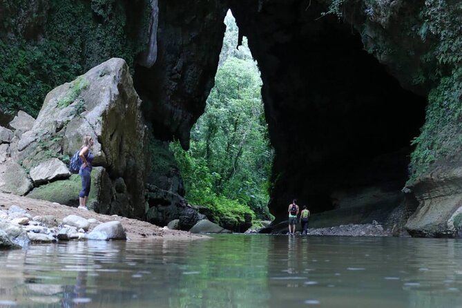
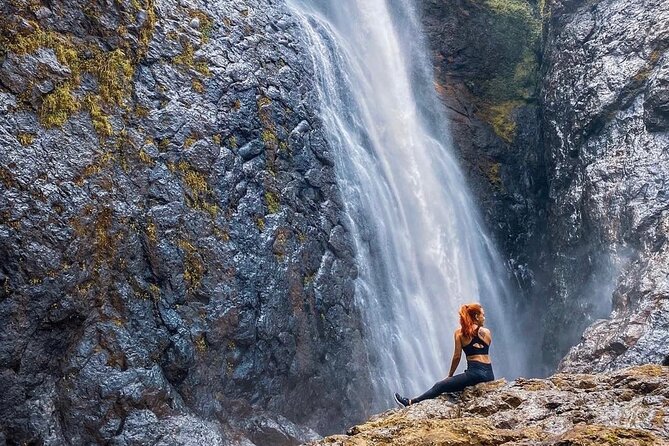
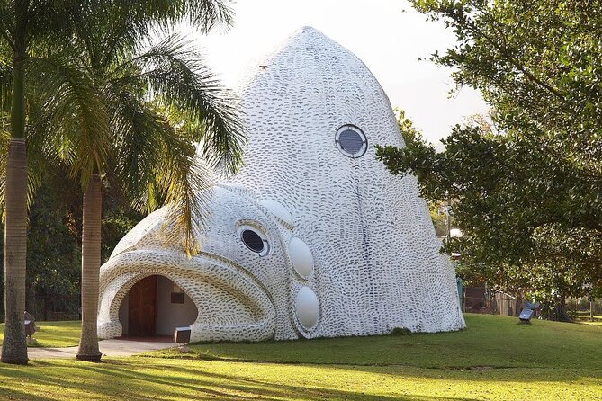
The Ponce section is for the curious. It groups more than 50 places that do not fit neatly elsewhere, including tunnels, unusual rock formations, waterfalls, large sculptures, and stairways with dramatic views.
This category may become a favorite if you have already seen the classic highlights and want stops that feel less predictable. It also helps solve a common road-trip problem: finding something interesting between major destinations.
The description covers a wide range of settings, so do not expect every stop to be equally easy or suitable for every age group. Some may call for walking, moderate fitness, or careful judgment. Use the photos and tips to choose sensibly rather than trying to collect every pin.
Day 7: More than 50 town plazas around Toa Alta
The Toa Alta section focuses on more than 50 town squares. These public spaces are described as places for music, children, pigeons, old trees, and everyday local life.
Plazas offer a welcome change from checklist sightseeing. You can stop for a short walk, observe the rhythm of a town, and connect a historic church or food stop with a central gathering place. They are also useful when you want a low-cost activity that does not depend on perfect weather.
The map does not promise events or performances at any specific plaza. Treat the descriptions as guidance, not a schedule. The value here is the chance to see town centers across the island at your own pace.
Day 8: More than 87 sacred sites near Carolina
The final category includes more than 87 sacred places, from major cathedrals to modest chapels on hillsides. You do not need to be religious to appreciate the architecture, setting, and role these buildings play in Puerto Rican communities.
This is another strong rainy-day option, although individual sites may have worship services or access restrictions. Dress and behave respectfully, and check the information for opening details before making a long drive.
The large number of locations means you can choose sites near your existing route. You do not need to turn the category into a full religious itinerary. One church or chapel can add a meaningful pause to a day focused on food, history, or scenery.
Why the map can save serious planning time
The strongest benefit is organization. You may be able to find many of these places elsewhere, but locating them one by one takes time. The map puts them into categories and gives you a direct route from the pin to Google Maps.
That convenience changes how you plan. Instead of beginning with a blank page, you can select a region, compare nearby options, and build a route around your interests. One person can search for rivers, another for food, and another for historic sites without needing separate research systems.
The map also helps you make better use of an unplanned afternoon. If your original activity falls through, you can open the list and choose another location. That flexibility was repeatedly praised in the supplied comments, especially by people who felt it saved hours of online searching.
I would not treat the map as a substitute for local advice, weather checks, or current opening information. It is a strong starting point and navigation aid. You still need to confirm the details that matter on the day.
Price, group value, and the real extra costs
At $29.99 per group of up to 15 people, the price is easy to justify for a family or group sharing one phone-based resource. Split among several people, it costs very little compared with even one paid attraction.
The value comes from time saved as much as from the number of locations. If the map helps you avoid several hours of research or leads you to one worthwhile stop you would otherwise miss, the purchase can pay for itself in convenience.
Budget for the rest of the trip separately:
- Rental car and transportation
- Fuel and tolls
- Parking
- Entrance fees where required
- Meals and drinks
- Personal expenses
- Equipment rentals for river or cave activities
Most places are described as free, but some sites and parking areas may charge. The digital map does not include transportation or a guide, so this is not the right purchase if you want hotel pickup, a driver, or someone leading the group.
There is also a small point to clarify before booking. The price is listed for a group of up to 15, while the activity information gives a maximum of 30 participants. Since this is a self-guided product, confirm how that limit applies if you are organizing a larger party.
Who will get the most from this experience
I would recommend the map most strongly to independent visitors with a rental car and a flexible schedule. It suits people who want choices instead of a fixed bus route, and it works well for families, groups of friends, and solo explorers who enjoy planning as they go.
It is especially useful for:
- An eight-day island trip with time beyond San Juan
- Repeat visits to Puerto Rico
- Groups with different interests
- Road trips that need backup options
- People who dislike spending hours researching scattered websites
- Visitors looking for more than beaches and major attractions
It is less suitable if you want a fully guided experience, included transportation, or a tightly scheduled daily program. It also requires a moderate physical fitness level for some river, cave, waterfall, and walking locations.
The suggested starting point is Plaza Colón at FV8Q+C57, C. de la Fortaleza, San Juan. That address functions as the meeting point in the booking details, but there is no stated guided departure from there. The activity ends back at that meeting point in the supplied information, so confirm the practical arrangement before you rely on it as a physical tour start.
How to use the map without wasting your vacation
Start by grouping pins by area rather than trying to cross the island repeatedly. Pick one main activity for the day, then add nearby food, history, or scenic stops. A map with 500-plus locations can create a new problem: too much choice.
Keep your daily list short. Four hours is a reasonable planning block, but travel time, parking, walking, meals, and weather can quickly stretch it. Select two or three priority stops and mark the rest as optional.
Download or screenshot essential information before leaving reliable service, if the map allows you to do so. The supplied details confirm mobile access and direct Google Maps links, but they do not promise connectivity at every remote river, cave, or mountain location.
Use the photos and tips as decision tools. A location that looks perfect in a picture may not suit your group’s fitness level, weather conditions, or available daylight. And for rivers, sunny weather with no rain forecast is not a suggestion to brush aside. It is the key safety rule.
Should you buy Puerto Rico Unlocked?
Buy it if you want a self-guided Puerto Rico road trip with a large pool of choices, direct navigation, and lifetime access to updates. The low group price is particularly appealing, and the strongest praise centers on the map’s organization, its ability to save research time, and the ease of finding places beyond the standard route.
Skip it if you want a guide, transportation, included activities, or guaranteed conditions at each stop. You will still need to rent a car, pay your own expenses, check weather and opening information, and decide which locations are safe and practical.
For independent explorers, this is a useful planning companion rather than a traditional excursion. I would buy it before an island-wide driving trip, then use it selectively so the map serves your vacation instead of turning it into a race to visit every pin.
FAQ
How much does the Puerto Rico map cost?
The price is $29.99 per group of up to 15 people.
How many locations are included?
The digital map includes more than 500 locations across Puerto Rico.
Is this a guided tour?
No. It is a self-guided digital map with no fixed schedule, transportation service, or guide included.
How do I navigate to each location?
Tap a location pin on your phone, then open the linked location in Google Maps for GPS navigation.
How long is the experience?
The experience is described as approximately eight days, with about four hours listed for each themed day.
Do I need a rental car?
Transportation is not included, and the experience is designed for road trips and self-driving. You should plan to arrange your own transportation.
Are entrance fees included?
No. Most places are free, but some sites or parking areas may charge an admission or parking fee.
Are meals and drinks included?
No. Meals, drinks, and personal expenses are not included.
Is equipment provided for river or cave visits?
No. Equipment such as helmets and life jackets is not provided.
What should I know before visiting rivers?
Check the weather first and choose only completely sunny conditions with no chance of rain. Rivers can become dangerous after rain because water levels and currents may rise quickly.
Just added around Puerto Rico
- Yunque Rainforest Waterslides Plus Beach Tour★ 5.0 · 3 reviews
- Ponce: Walking City Tour, Entry Seralles Museum & Dinner Included★ 5.0 · 18 reviews
- Visit Local Bars at Art District in San Juan★ 5.0 · 4 reviews
- VIP Small Group El Yunque Rainforest Adventure★ 5.0 · 19 reviews
- Ultimate Beginner Snorkeling Tour★ 5.0 · 2 reviews
- Rio Tanama City Tour with Car Transportation★ 5.0 · 2 reviews
- ToroRoller★ 4.5 · 3 reviews
- Taino Hidden Caves Guided Tour★ 5.0 · 4 reviews